TAKE PICTURE
PROCESS
EVALUATION
SCAN
PROCESS
EVALUATION
SCAN
PROCESS
EVALUATION
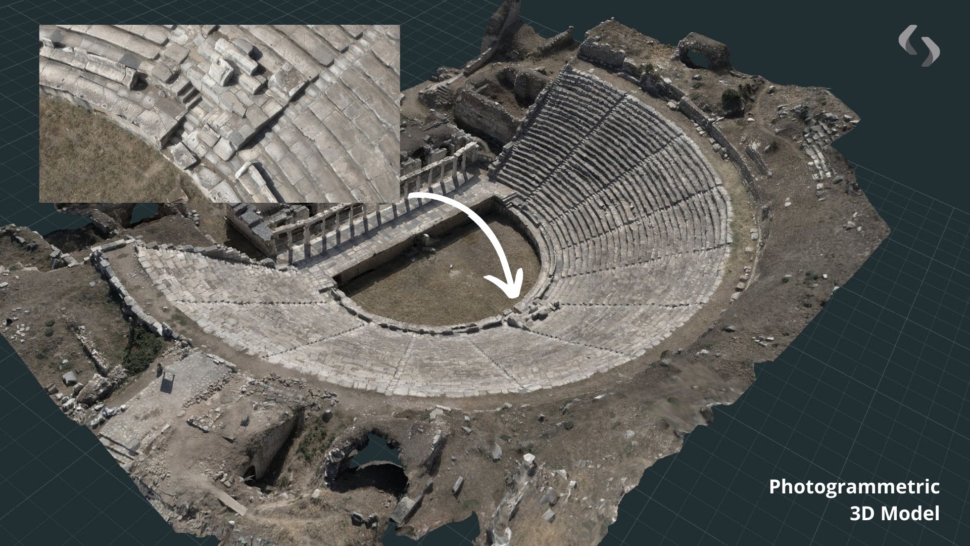
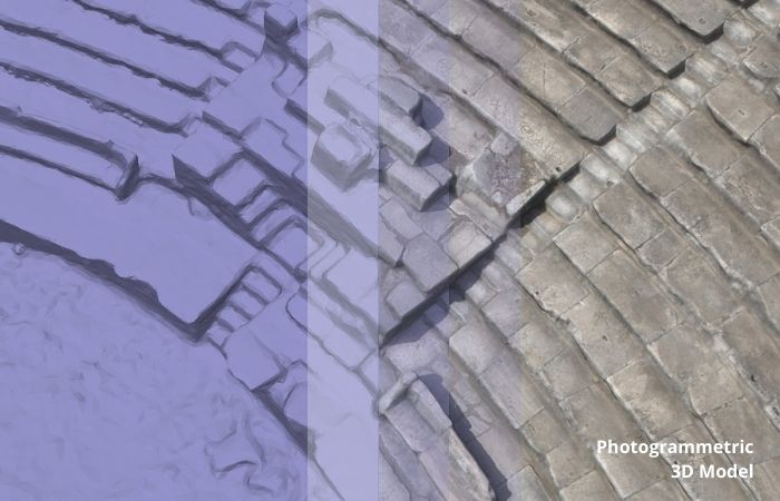
At Survey Hands, we use photogrammetry to create detailed and photorealistic 3D models based on real world spaces. This method captures accurate shape, texture and scale, making it ideal for projects that require high visual quality and reliable spatial detail.
WHAT YOU WILL GET
PHOTOGRAMMETRIC 3D MODEL
Photogrammetry is a method where we use high quality 2D images to create a detailed 3D reconstruction of your space. At Survey Hands, we use this approach when a photorealistic digital copy is required, producing accurate and visually realistic models of your area.
PHOTOREALISTIC 3d COPY of YOUR SPACES
We use photogrammetry across a wide range of sectors and project types. This approach allows us to deliver accurate 3D models of your property, along with outputs such as digital elevation models, digital surface models, orthomosaics and as built maps of your space.
EMBED ALL MEDIA
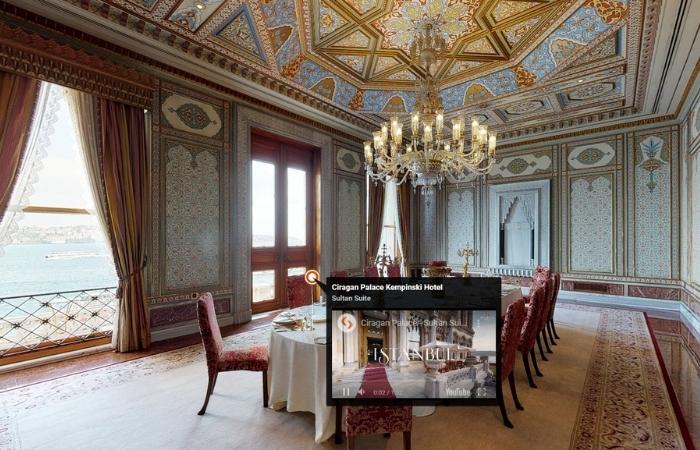
Mattertags are pop-up windows within your 3D models that enrich the digital twin experience with additional information on features. A great way to highlight points of interest in your property tour.
DIGITAL ELEVATION MODEL
A digital elevation model is a 3D representation of terrain created from elevation data, showing ground shape and height in a clear and accurate format.


PHOTOGRAMMETRIC MAP
We prepare photogrammetric as built maps for sites and large open areas, providing accurate and detailed records of existing ground conditions.
GOOGLE STREET VIEW
Matterport 3D virtual tour is not only just a virtual tour but also you will get publish your 3D space on Google Maps. This is the best and quick way to share your property on google maps platform.

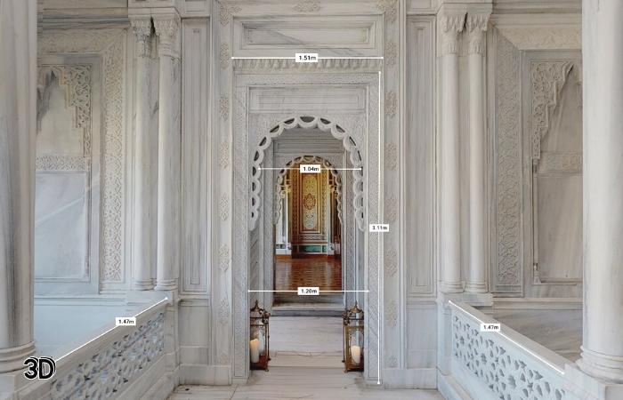
INTERACTIVE 3D MEASUREMENTS
Matterport 3D digital twins gives you the ability to share measurements taken in a 3D digital twin with anyone. Allowing them to accurately measure rooms, windows, doors, or furniture with a simple click or tap on a PC or mobile device.
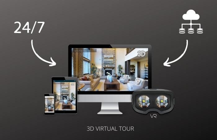
REACH THE DATA 7/24
All your 3D virtual tour data will storage in cloud and you can reach the data whenever you want 7/24 online & offline. When you need a revision you will see lates result at sama URL link. That is a revolution.
REACH THE DATA 7/24
All your 3D virtual tour data will storage in cloud and you can reach the data whenever you want 7/24 online & offline. When you need a revision you will see lates result at sama URL link. That is a revolution.
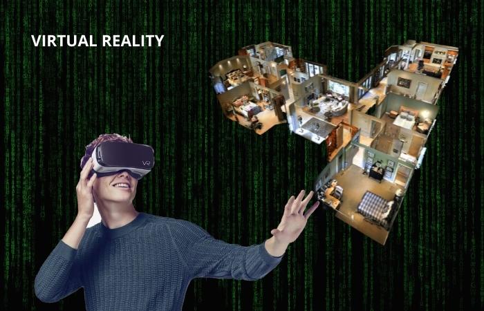
YOUR SPACE in VR
Immersive virtual reality for your sector, could help reverse the fortunes of walk-in business. Your clients can simply put on a headset and enjoy viewings that immersive replicate of your areas.
VIRTUAL STAGING
If you have a Matterport 3D digital copy of your space, we can put 3D furniture objects in your space. This attracts more potential buyers and you sell faster and for more money than before

PHOTOGRAMMETRIC VIDEO TOUR
We can create professional video content from your 3D digital copy, including aerial style views that show the full layout of your property. These videos help customers understand your space and allow us to present your services clearly through structured and engaging visual content.

4K PRINT OUT
When you have Matterport 3D digital twin, you don’t need to find photographer for your space. We can export 2D images of your business in 4K resolution and contribute to the development of your business.
4K PRINT OUT
When you have Matterport 3D digital twin, you don’t need to find photographer for your space. We can export 2D images of your business in 4K resolution and contribute to the development of your business.