What is BIM ?
Building Information Modeling (BIM), with its most basic definition, is the process of sharing 3-dimensional information, which is a digital representation of the physical and functional properties of buildings, which can be used jointly by those who undertake tasks in the design, construction and maintenance of different architectural projects.
BIM adds significant value and professionalism to engineering projects, as it is a multi-disciplinary collaborative concept.
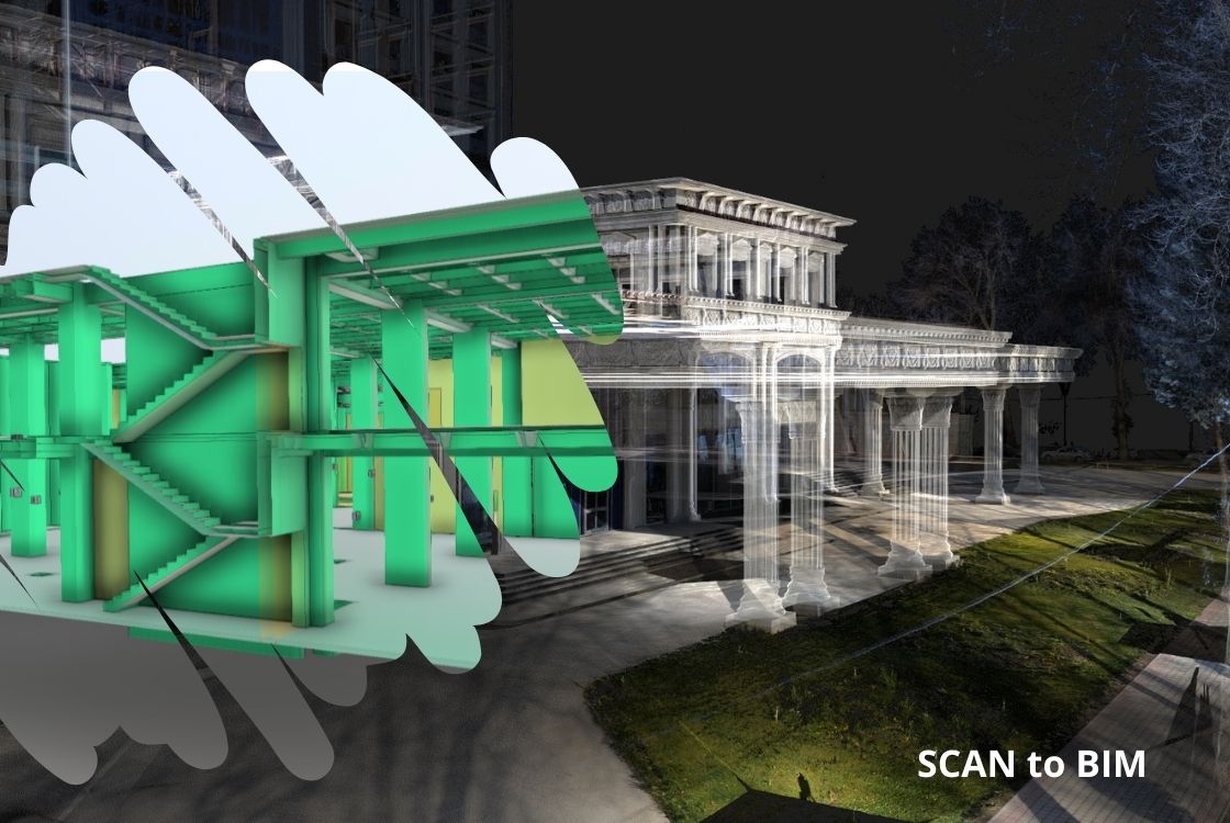
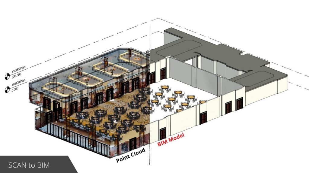
Scan to BIM
The Scan to BIM method is the step of converting the point cloud data obtained as a result of laser scanning into a model with all the details of the building.
The BIM model, which is created from point cloud data obtained using laser scanners, provides much more reliability and quality assurance.
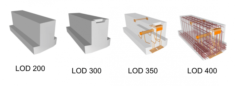
Level of Details in Modelling (LOD)
Level of Detail (LOD) is to define the amount and degree of building information that should be placed in a BIM Model. This includes not only graphic objects or physical properties, but also the data associated with the objects.
Usage Areas
BIM can be used for the following purposes;
- 3D Visualisation
- Production Drawings
- Evaluations Regarding the Regulation
- Forensic Analysis
- Facility Management
- Cost calculation
- Conflict, Interference and Conflict Research
- Use in the building construction process
- Use in building operation
- Use in a GIS context
- Use in Structural/Environmental Analysis
Benefits of SCAN to BIM
- Shows all the details completely
- It enables processes to become fast and efficient.
- Real-time data collection and information management
- Fast response on projects
- Ability to edit and update anytime
BIM PROJECT | TAJIKISTAN
The ‘Scan to BIM’ approach was used to produce a BIM model of a hotel in Tajikistan. While the point cloud data obtained by laser scanning was processed, the required LOD level was determined, and the modeling process was started.
Within the scope of the project, Riegl VZ400i laser scanner was used for laser scanning. Data were collected from 2700 scanning points for 19 floors with a floor size varying between 1500-1700 m2. The whole scanning was completed within 10 days.

PROGRAMS USED IN THE SCOPE OF THE PROJECT
While Riegl Riscan program was used in laser scanning processes, Autodesk Recap and Nubigon were used for visualisation and editing of point data.
Also, Autodesk Revit is used to create the 3D solid model (BIM).
Autocad – Collaborate Pro is used in order to coordinate the progress of this collaborative work. This makes it possible to prevent misalignments and catch errors earlier.

Sample Projects
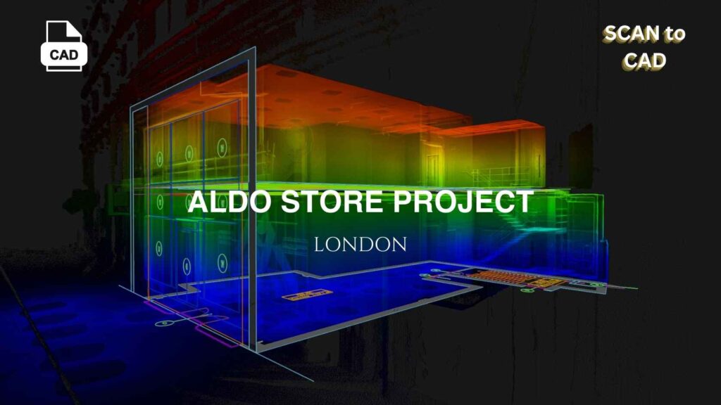
In this project, we measured all structural details with laser scanning and produced highly accurate CAD drawings, minimising the time the architectural team needed to spend both on-site and in the office.
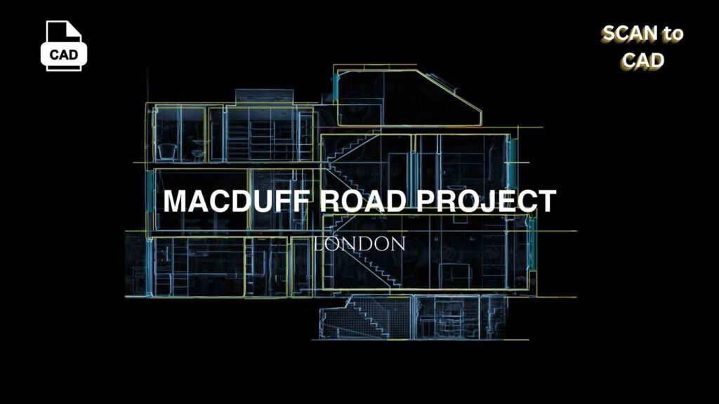
At Macduff Road, as-built drawings were required for a building. We first used laser scanning to capture the entire area, then created a 3D virtual model to eliminate the need for the architectural team to revisit the site. Afterward, we provided all necessary CAD drawings, allowing the team to review details through the 3D model and smoothly transition to design and planning using the CAD data.